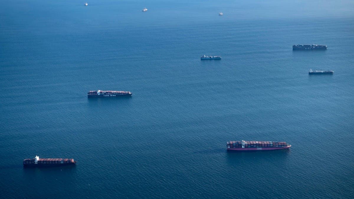
Technology to hide a ship’s location previously available only to the world’s militaries is spreading fast through the global maritime industry as governments from Iran to Venezuela — and the rogue shipping companies they depend on to move their petroleum products — look for stealthier ways to circumvent US sanctions.
Windward, a maritime intelligence company whose data is used by the US government to investigate sanctions violations, said that since January 2020 it has detected more than 200 vessels involved in over 350 incidents in which they appear to have electronically manipulated their GPS location.
For the latest headlines, follow our Google News channel online or via the app.
“This is out of hand right now,” Matan Peled, co-founder of Windward and a former Israeli naval officer, said in an interview. “It’s not driven by countries or superpowers. It’s ordinary companies using this technique. The scale is astonishing.”
Peled said US authorities have been slow to catch on to the spread of technology that has been part of the electronic warfare arsenal for decades but is only now cropping up in commercial shipping, with serious national security, environmental and maritime safety implications.
Windward was able to identify suspect ships using technology that detects digital tracks that don’t correspond to actual movements, such as hairpin turns at breakneck speed or drifting in the form of perfect crop circles.
William Fallon, a retired four-star admiral and former head of the US Pacific Command, said US authorities have been aware for some time of the threat from electronic manipulation, one of a growing number of so-called “gray zone” national security challenges that cut across traditional military, commercial and economic lines.
“Any time you can deceive somebody into believing you’re somewhere where you’re not is concerning,” said Fallon, who is now a board member of the American Security Project, a Washington think tank. “It illustrates the extent to which people who don’t have any scruples are willing to go to achieve their objectives and the ease with which they can do it.”
One of the more egregious examples found by Windward involves a 183-meter-long oil tanker that could be tracked sailing to Iraq even as it was in reality loading crude in Iran, which is banned from selling its oil by US sanctions.
The tanker, whose name Windward asked to be withheld so as not to disrupt any potential US government investigation, set sail on February 11, 2021, from the United Arab Emirates, reporting its destination as Basra, Iraq. When it was 20 nautical miles away, its global navigation system began exhibiting strange drifting patterns. Twelve days later, its transmission stabilized, and it could be tracked heading back through the Hormuz strait at normal sailing speed, this time fully laden with crude.
Satellite imagery shows that during the two-week voyage a ship of identical length and with the same red deck broken up by a white pole and bridge was spotted dozens of nautical miles away, in Iran’s Kharg Island oil terminal. That vessel was then followed on satellite sailing back to the UAE, its course merging with the reported position of the original ship after it resumed its normal transmission.
Under a United Nations maritime treaty, ships of over 300 tons have been required since 2004 to use an automated identification system to avoid collisions and assist rescues in the event of a spill or accident at sea. Tampering with its use is a major breach that can lead to official sanctions for a vessel and its owners.
But what was intended as an at-sea safety mechanism has also driven a proliferation in ship-spotting platforms like MarineTraffic.com.
Experts say such websites can be easily tricked since they partly rely on data gathered from thousands of amateur base stations that function like police radio scanners picking up maritime movements. Last year, two journalists from the Norwegian Broadcasting Corporation managed to register online a fake base station near Somalia and insert the false coordinates of a real vessel. Seconds later, the falsified location popped up on MarineTraffic.com.
“To minimize errors and always ensure data integrity, MarineTraffic has introduced a series of key actions in the last few months as we strive to keep securing incoming data further,” MarineTraffic’s Anastassis Touros said in a statement. Steps include blocking specific stations and IP addresses that consistently transmit false data.
Despite such quality control efforts, the sheer volume of data has cut into the utility of such open-source platforms, two US intelligence officers told The Associated Press. The officials spoke on the condition of anonymity to discuss what they described as the latest — and most extreme — tactic in the cat and mouse game between authorities and bad actors.
Another blind spot: China. The recent implementation of a harsh data privacy law has cut by nearly half the amount of terrestrial data on maritime activity in Chinese waters, making it harder to track everything from activity at busy ports key to global supply chains to the movements of the world’s largest distant water fishing fleet.
Researchers from Global Fishing Watch, which uses satellite data and machine learning to monitor activity at sea, have made similar findings as Windward. It has identified 30 vessels whose locations, as reported on ship-tracking platforms, regularly fell outside the range of the satellite receiving the ship’s position.
Among the vessels caught suspected of falsifying its digital tracks was the Tulip, a Panama-flagged oil tanker. For almost six months last year, it broadcast its position along the west coast of Africa. But the satellite that should have picked up the ship’s movements was often thousands of miles away, suggesting the ship was likely in Venezuela.
The Associated Press obtained internal documents from Venezuela’s state-owned oil company indicating the Tulip loaded 450,000 barrels of fuel oil during the first 15 days of September. Like several other of the suspicious vessels, the crude was purchased by a shell company, M and Y Trading Co., registered in Hong Kong in November 2020, according to the documents. The Tulip is owned by another Hong Kong-registered shell, Victory Marine Ltd. Neither company returned emails seeking comment.
Bjorn Bergman, a data analyst for Global Fishing Watch and Sky Truth, said attempts to hide a ship’s position can be easily detected.
“While we need to remain vigilant, vessel operators choosing to manipulate their data are just going to end up shining a spotlight on their activities,” he said.
Of the 200 vessels identified by Windward with similar patterns of deception, the vast majority exhibited no other or just a few classic red flags such as disabling on-ship tracking systems, falsifying a vessel’s flag state or constantly changing ownership from one shell company to another.
These shipping practices have become clear indications for possible involvement in sanctions evasion and are described as such in a 2020 advisory by the US State and Treasury departments and the US Coast Guard.
But the advisory, heralded as an important step to crack down on the shipping companies that do business with US adversaries, makes no mention of the latest GPS trick to hide illicit trade in oil, seafood and other products. As a result, the practice has exploded into what Windward has called a “free for all” with no immediate end in sight
“The vast majority of these vessels were meticulously chosen for these missions because they are otherwise well behaved,” said Dror Salzman, a risk product manager at Windward. “If you walk to a bank with a ski mask on, everyone knows what you’re up to. But here it’s like they are working from the inside with the teller. Nobody can see them.”
Read more:
Iranian supertanker carrying condensate docks in Venezuela
China says it warned away US warship in South China Sea
Iran-backed Houthis reject UN request to release seized UAE-flagged vessel

 World3 years ago
 World3 years ago
 Business11 months ago
 Entertainment7 years ago
 World7 years ago
 Entertainment7 years ago


